Belgium
Eendracht maakt macht
(Unity makes strength)
History
Geography
Armed forces
Religion
Education
Belgium has three main geographical regions; the coastal plain in the northwest and the central plateau both belong to the Anglo-Belgian Basin, and the Ardennes uplands in the southeast to the Hercynian orogenic belt. The Paris Basin reaches a small fourth area at Belgium's southernmost tip, Belgian Lorraine.
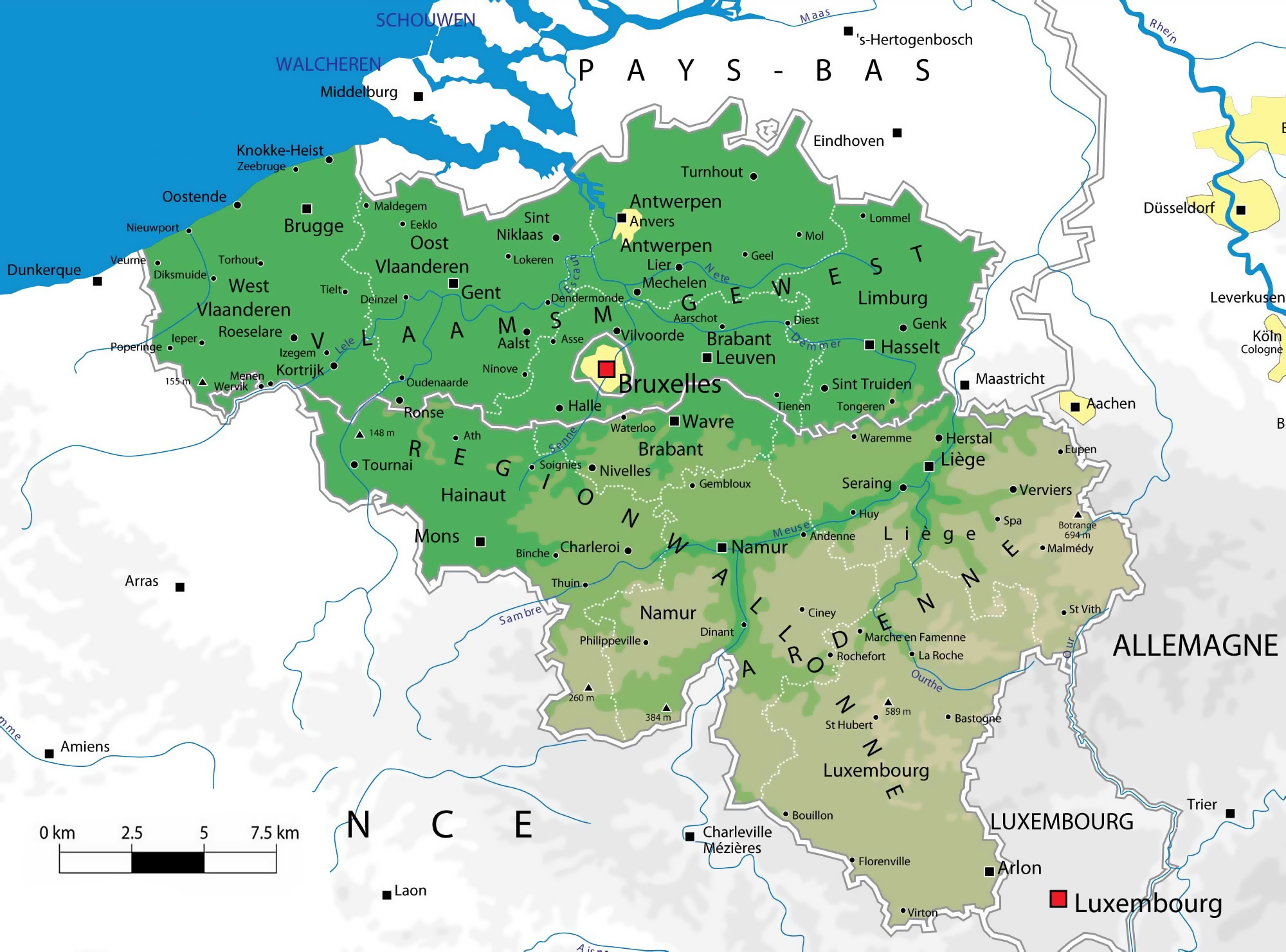
The coastal plain consists mainly of sand dunes and polders. Further inland lies a smooth, slowly rising landscape irrigated by numerous waterways, with fertile valleys and the northeastern sandy plain of the Campine. The thickly forested hills and plateaus of the Ardennes are more rugged and rocky with caves and small gorges. Extending westward into France, this area is eastwardly connected to the Eifel in Germany by the High Fens plateau, on which the Signal de Botrange forms the country's highest point at 694 m.
The climate is maritime temperate with significant precipitation in all seasons, like most of northwest Europe. The average temperature is lowest in January at 3 °C and highest in July at 18 °C. The average precipitation per month varies between 54 mm for February and April, to 78 mm for July. Averages for the years 2000 to 2006 show daily temperature minimums of 7 °C and maximums of 14 °C and monthly rainfall of 74 mm; these are about 1 °C and nearly 10 millimeters above last century's normal values, respectively.
Phytogeographically, Belgium is shared between the Atlantic European and Central European provinces of the Circumboreal Region within the Boreal Kingdom. According to the Worldwide Fund for Nature, the territory of Belgium belongs to the terrestrial ecoregions of Atlantic mixed forests and Western European broadleaf forests. Belgium had a 2018 Forest Landscape Integrity Index mean score of 1.36/10, ranking it 163rd globally out of 172 countries.